Archives of Lake of the Woods
Establishing the Boundary
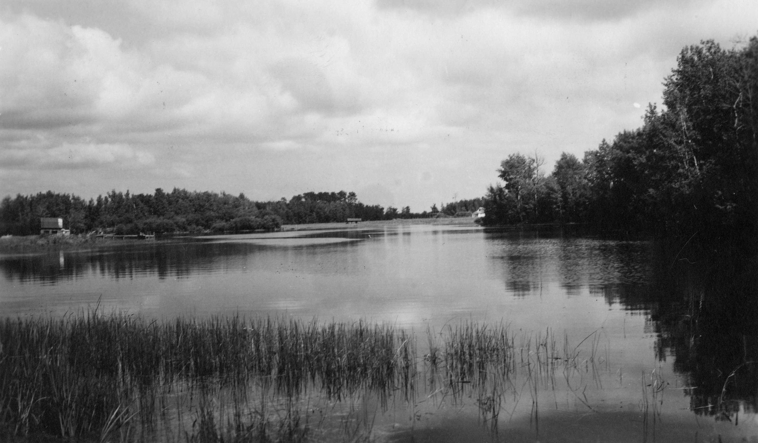
In 1823, members of the International Joint Boundary Commission arrived on the lake. They had been appointed to establish the border between Canada and the U.S., as it had been designated in the treaty which ended the Revolutionary War. One of the difficult points of contention was the establishment of the most northwesterly point on the Lake of the Woods as called for in the treaty. The dispute over the exact location of this point continued for the next century and a final agreement was not signed until in the 1920s. The end result was that the U.S. retained possession of the Northwest Angle, that odd projection of land which juts out above the border and is completely disconnected from the rest of the nation.
The First Settlements
Following the end of the fur trade, most of the activity along the Rainy River and the lake was limited to movements of people going to Lord Selkirk’s Red River Settlement in what would become Manitoba. In 1857 an overland route called the Dawson Trail was established. Though nearly all Canadian, this route cut across a corner of the Northwest Angle at the mouth of Harrison Creek on Angle Inlet. A small town grew up at this location where travelers left the steamboats from Fort Frances to board stage coaches for Winnipeg. This town at Harrison’s Creek, known as Northwest Angle, became the first settlement within the borders of what would become Lake of the Woods County. A few years later, however, when the railroad reached Kenora and Winnipeg, the trail was abandoned and the village all but disappeared.
The coming of the Canadian Railroad brought the next residents of the county. They were Canadian loggers who came to pirate American timber for the lumber mills at Kenora which were busy sawing ties for the railroad. But, in 1885 the county got its first permanent settlers when Alonzo Wheeler and Wilhelm Zippel squatted on the shores of Rainy River and Lake of the Woods. Both engaged in commercial fishing enterprises.
In the 1890s more settlers followed Zippel and Wheeler. Most of the earliest arrivals chose likewise to make their homes on the shores of the lake and fish for a living. Barney Arnesen settled at Rocky Point, the Asmus family lived first at Long Point. Ole Johnson ran a fishery on Pine Island where Morris Point Gap has since been forced through by current.
LeClaire, a small community, grew around two fisheries at Oak Point on the east end of Curry’s Island on Four Mile Bay. This was the first truly American settlement in the county and the site of the first post office and customs house.
Organization
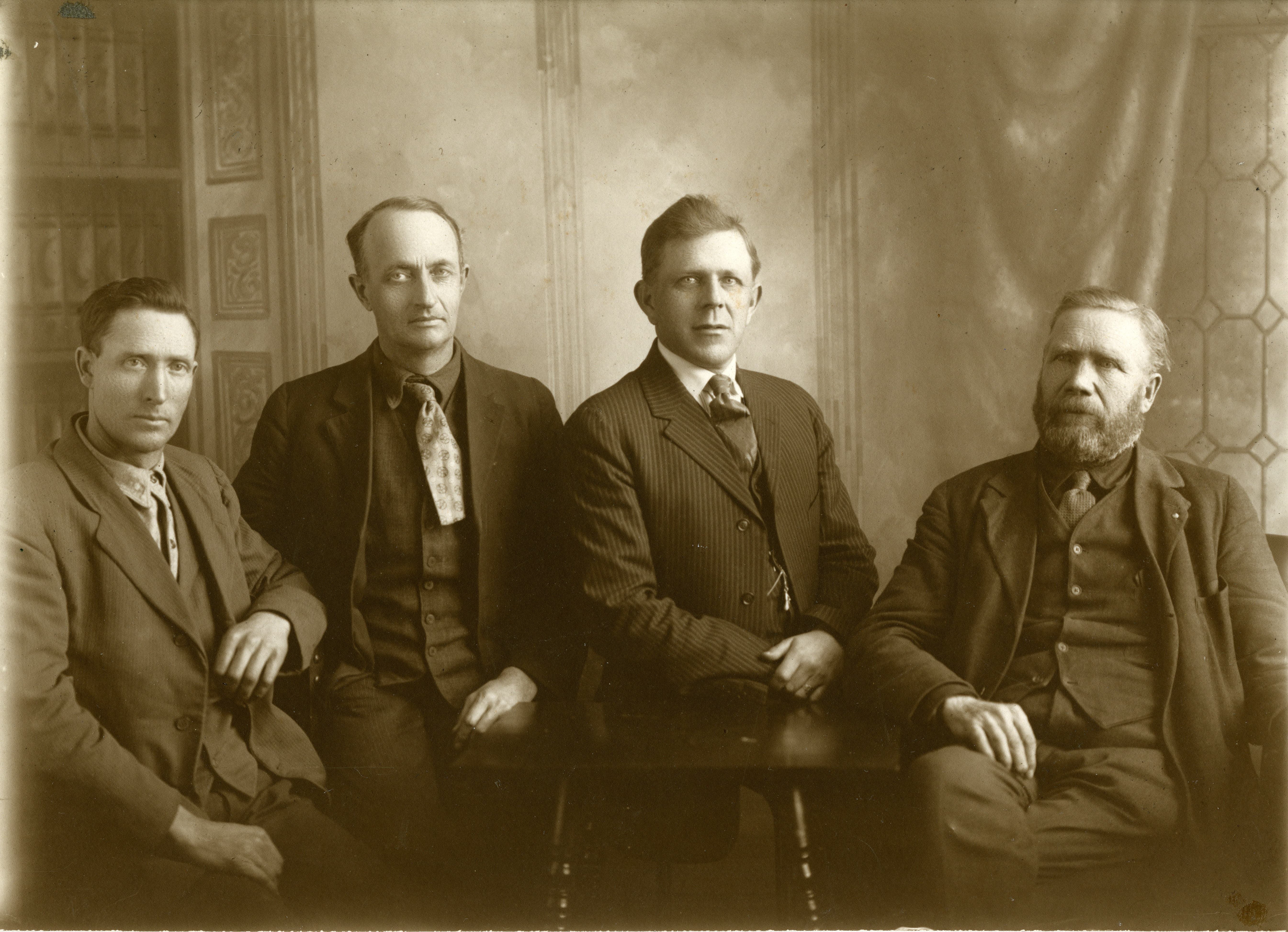
Lake of the Woods County was organized on November 28, 1922, when a vote by area residents separated the northern townships from Beltrami County. On January 1, 1923, the county officially began operations at its county seat in Baudette, Minnesota.
Becoming a County
Local residents were dissatisfied with the services they received from Beltrami County compared to the amount of tax dollars they paid. Being on the fringe of the large county, they felt they were often short-changed. The distance between the northern townships and the county seat at Bemidji and the difficulty in making the two or three day trip to Bemidji by train through Crookston or International Falls contributed to this feeling. In November of 1922, the vote for separation carried. The first years for the new county would be difficult ones. A small population and a depression in the local economy combined to cause financial problems from the start.
Pre-History
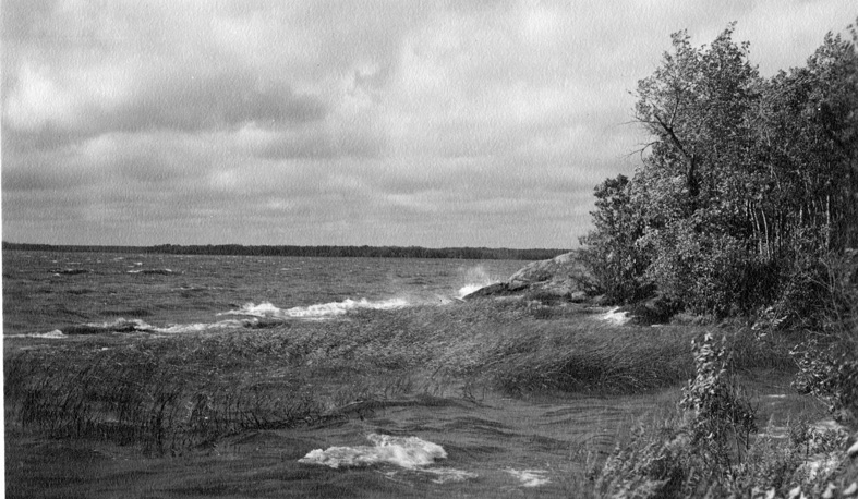
Before the advent of man around the Lake of the Woods, fire, water and ice worked to shape the land that today forms the county. Volcanic action and movements in the earth’s crust formed the first surface of this region. Erosion and volcanism worked alternately through time until a high, rocky chain of mountains was thrust up. The land that would be Lake of the Woods County was on the southwestern edge of this mountain range. Forces of erosion eventually wore the mountains down to their hard bases. Outcroppings of these rocks form the islands of the lake and appear occasionally jutting-out above the land area of the county. The rugged rock and lake terrain that remains today is known as the Canadian Shield, which ends in the Lake of the Woods. The rocks that form this shield are among the oldest on earth.
During the Ice Age, four major ice sheets covered northern Minnesota. When the glaciers withdrew, a lake formed between the height of the land to the south and the ice walls to the north. Known as Glacial Lake Agassiz, it submerged the county as well as part of the rest of Minnesota, North Dakota and a large portion of Canada. Eventually this lake shrank to leave the Lake of the Woods as a remnant body of water. The waters of the Lake of the Woods, like those of Lake Agassiz, flow north to empty into Hudson Bay.
A succession of beaches, sandy ridges, formed as the large lake shrank. One of the last of these was Campbell Beach, a sand ridge which is still noticeable as it runs across the county from north of Roosevelt to Pitt and south of Baudette.

First Residents
The Paleo-Indians possibly followed herds of mammoth along the icy water of Lake Agassiz as it lapped Campbell Beach. For certain, an Archaic people, those of the Old Copper Complex (3,000 to 1,000 B.C.) entered this part of northern Minnesota from the east, probably following the lake route that would later serve the voyageurs.
The first people to leave an extensive archaeological record were those of the Laurel Culture. They dominated the area from 200 B.C. to 800 A.D. They were mound builders and built several burial mounds along the Rainy River. They were part of the Woodland Pattern and survived by hunting and gathering. Various plants, berries, moose, beaver and fish, especially sturgeon, sustained the people.
The Blackduck Culture succeeded the Laurel in about 800 A.D. They utilized the mounds of their predecessors and built additional burial mounds of their own for their dead. A culture identifiable as Blackduck disappeared around 1,400 A.D.
At the time of the first European exploration in the region, northern Minnesota was populated by Cree, Monsonis, Assiniboine and Sioux Indians. The Ojibwa, however, would shortly push their way westward to become the masters of the border area.
Exploration & Fur Trade
The first European adventurer credited with seeing Lake of the Woods was Jacques De Noyon of Three Rivers, Quebec, who paddled his way to the mouth of the Rainy River in 1688. Following his arrival, the next known explorer was Pierre La Verendrye. He came with a party of more than 50 men in 1732.
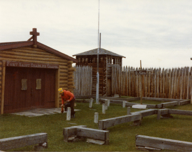
La Verendrye established Fort St. Charles on Magnusson’s Island and managed the exploration work which would eventually open up the north and west to a tide of traders who came to gather the rich harvest of furs provided by the forest and lake environment. The post he established was abandoned by 1763. Today a reconstruction of the old fort occupies the exact site on Magnusson’s Island.
British possession of the land west of Lake Superior began the golden age of the voyageurs, which, with their canoes, became the main characters in the story of this region for the next 75 years. Lake of the Woods was a major link in the voyageur’s highway with all of the trade returning from the north and west destined to cross the lake. All of the rival fur companies, Hudson Bay, Northwest, XY and American established posts as they struggled to monopolize the trade. Posts of the various companies stood at different times at and near the mouth of the Rainy River. By the 1830s, the American Fur Company won the monopoly of trade on the southern side of the border but by the early 1840s the fur trade, as it had been, was finished.
Lasting Settlements
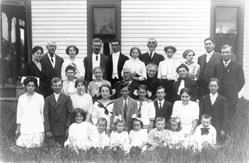
Thomas Cathcart came to the border area in 1891. Working at the Beaver Mill in Rainy River, Ontario, he soon became attracted to the unsettled American side of the river. He moved to the south bank, settling at the mouth of the Beaudette River which, like the Rainy, had received its name during the earlier fur trade days. The town which then quickly developed assumed the Beaudette name as well although the initial “e” was eventually dropped. In 1893, Cathcart’s family arrived from eastern Canada via Kenora aboard the Shamrock to become Baudette’s first family. Spooner, the village on the east bank of the Baudette River, was incorporated in 1906, the same year as Baudette.
Helic Clementson established his home at the mouth of the Rapid River in 1896. His brother Ole soon joined him and started a store around which the community of Clementson grew.
In 1901 with the arrival of the Canadian National Railroad across the county, the county got its first settlement boom. William Mason and George Williams followed the track roadbed to stake claims at the site which would become Williams. The towns of Pitt, Graceton, Cedar Spur and Roosevelt sprang up along the rail line in a matter of months. Settlements also spread up the Rapid River to Hay Creek and Carp.
Early Industry
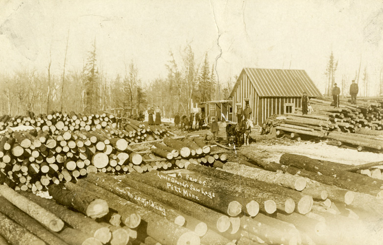
Logging became the principal industry. Most of the homesteads were still covered with timber. What fields there were, were small and used to grow enough grain for animal feed and for household use. Homesteaders earned their money by cutting and selling their wood to various buyers.
Several large sawmills were established early on at both Baudette and Spooner. Timber was floated down the tributaries of the Rainy River to the mills or hauled to the various railroad depots for shipment via rail.
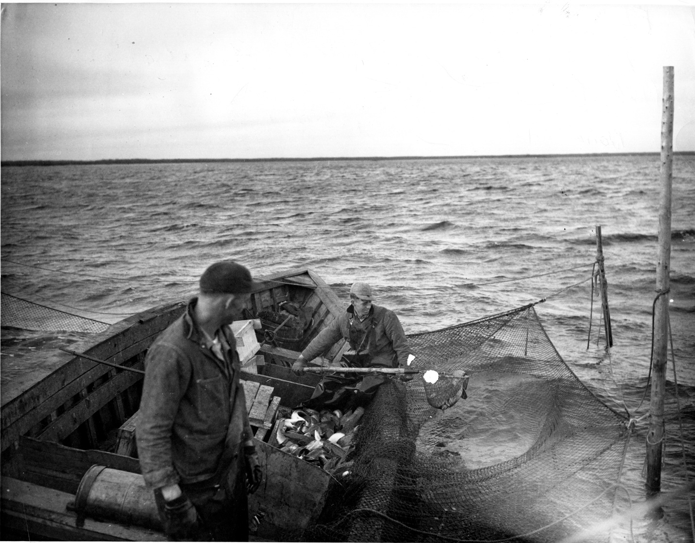
Commercial fishing continued to be a source of income for a number of families living along the shores of the lake and at the mouth of the Rainy River.
The Fire of 1910
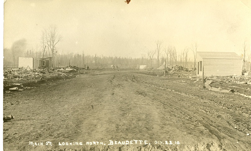
On October 7, 1910, a disaster struck which threatened to end the Lake of the Woods lumbering industry while it was still in its infancy. A forest fire raged out of control across the county, leveling everything in its path. By the end of the day the villages of Cedar Spur, Graceton, Pitt, Baudette and Spooner lay in ruins. Four hundred thousand acres were blackened. Homesteads across the county were destroyed and 43 lives were lost.
The aftermath of the fire was bleak. In the smoke-laden days following the fire, a mass grave was opened at Elm Park Cemetery for 27 of the fire victims. The wind-blown streets of the towns were barren except for the piles of rubble from the burned buildings and in the country the land was covered with ashes.
But, the lumber mills had been spared or saved. With these still intact there was some reason for optimism. With the help of the Red Cross and the National Guard, rebuilding began immediately and many homesteaders now turned to the task of land clearing and set their sights on agriculture.
Additional Settlements
After recovering from the fire, the county area experienced another settlement boom. Within the decade following 1910, nearly every 100 acre plot was claimed.
The new arrivals pushed settlement into the interior of the county, moving further from the railroad and the waterways. Bankton, Lovedale, Pilgrim Hall, Faunce, Hiwood Dutchie and Clover Point were a few of the post office communities that appeared in the newly settled regions. The wilderness trails that wind through the southern half of the county pass by the sites of these former villages and farms which have all been reclaimed by nature.
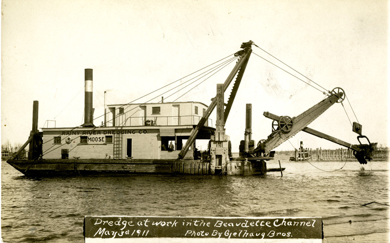
Much of the land that the settlers claimed was low and wet but an elaborate scheme to drain these regions was put into action. Beginning in 1912, dredges began digging their way across the swampy areas, excavating the Judicial Ditches that were supposed to leave the land dry and suitable for farming. The plan failed however and eventually many of the parcels were abandoned. Taxes for the ditches became delinquent and the county was forced to default on the loan it had received for the ditch work. The State of Minnesota eventually took up these payments and acquired title to the lands, thus creating the Beltrami Island State Forest.
Later Industry
In the early 1920s, the lumber mills ceased operating, commercial fishing had peaked and farming was not yet able to take up the slack. The area entered a local version of the Depression several years before the bust came to the rest of the nation. Several local business ventures attempted to fill some of the void left by the closing of the mills. A blueberry cannery, cigar factory and soda pop factory were among these shortlived ventures.
The early and mid-1920s saw the birth of the tourist industry in Lake of the Woods County, when resorts began to appear along the shores of the river and lake. Although several men had previously catered to a small number of tourists, providing guide and launch service, the Klimek family built the first local resort in the shelter of Four Mile Bay on the site of the present Wigwam Resort. Shortly after Klimeks started in business, Ed McGuire built a dance pavilion and resort on the river side of Wheeler’s Point and John Morris constructed a series of cabins at Morris Point, several miles west of the mouth of the river. In the following years, many more resorts were added along the shores of the Rainy River and the Lake of the Woods, and tourism started to generate revenue for the county.
It was in the decade of the 1930s that a nearly explosive development in local agriculture occurred. The fires of the 1930s, particularly 1931, prepared land for easier clearing. Technological advances had made available more effective tractors and farm equipment. An area normally marginally wet for crop production became very productive when the area as a whole was drier than usual. The new land was especially productive of legume seeds of extraordinary quality and purity which claimed a high price even during the Depression.
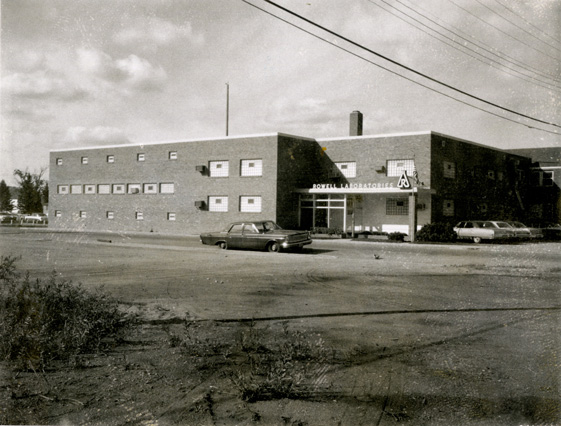
In the mid-thirties, Ted Rowell, Sr., started an industry based on a most unlikely resource, the burbot. Rowell discovered that the oil extracted from burbot livers was a rich source of certain vitamins and began manufacturing burbot liver oil products. In the years to come Rowell Laboratories went on to produce a range of pharmaceuticals and continues at the Baudette location today under the ANI Company.
Community Developments
The village of Williams was incorporated in 1923. Many of the other small towns along the railroad and in the outlying county areas diminished in size as the years progressed.
A government program to relocate settlers in the southern half of the county from lands that were considered marginal for farming began in 1935. Faunce, Bankton, Hiwood, Norris and neighboring communities soon lost nearly all their families and their existence ended. A CCC camp was established at Norris and other New Deal work agencies were active in the vicinity planting trees, building fire trails and re-establishing wildlife habitat.
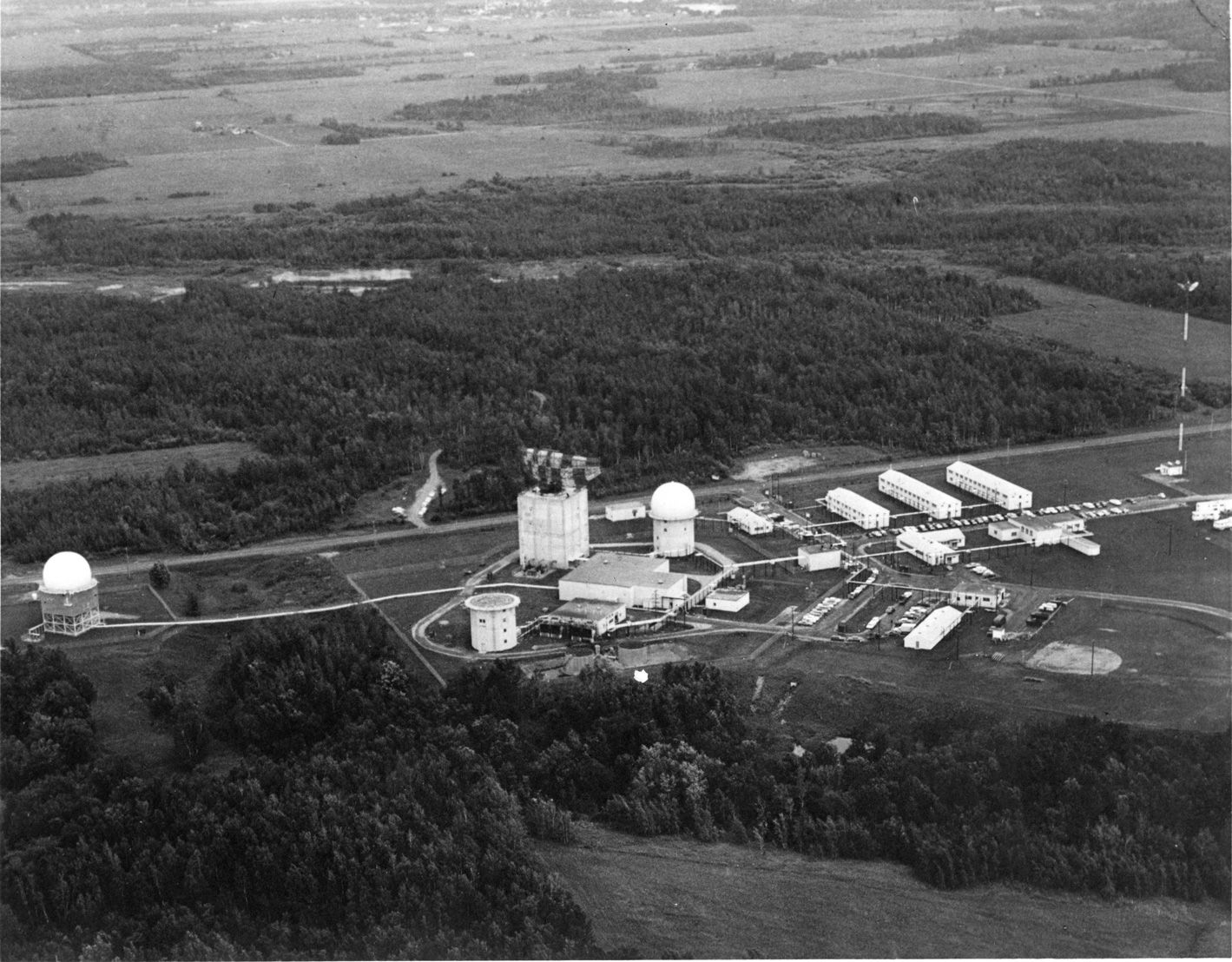
The villages of Spooner and Baudette combined in 1954. An Air Force base constructed southwest of town in 1957 brought an economic and social boost to the area for the next several decades. The county also found a niche in growing seed potatoes during this period. Logging, farming and resort industry continued to add diversity to the local economy. In the 1970s and 1980s, as many of these industries waned, the tourism industry continued to expand. New on the scene in the 1990s were several companies, Bosch and AET, establishing vehicle testing sites. The area’s long and cold winters were well suited to the needs of the businesses.
The attractions of Lake of the Woods County are much as they were when the pioneers came to settle. Fishing, hunting, forests, water, clean air and spaces to live and play in are once again drawing people to the area. Something of that pioneer spirit which enabled people to overcome the hardships of a wilderness survives in a population that is determined to make Lake of the Woods County a great place to live.
